Empowering Businesses with GIS
Transform your data into powerful spatial insights with enterprise GIS solutions, custom GIS tools, and data-driven decision-making.
Expert GIS Consulting
Specialized in Enterprise GIS, Web GIS, and Spatial Analysis
GIS Data Development, Advanced tools, automation for QGIS and ArcGIS
Secure GIS data storage, backups, and role-based access
Custom GIS Development
Cloud & Database Management
Our Story
Throughout history, revolutions have shaped how we work and live—the Agricultural Revolution, Industrial Revolution, and the Internet Revolution. Today, we believe the next transformation is the GIS Revolution—where every information system integrates with GIS for smarter decision-making.
At GEODARS, we are at the forefront of this movement, helping businesses, researchers, and governments leverage Geographic Information Systems for better insights, efficiency, and growth.


Our Mission & Vision
📌 To enable organizations to unlock the full potential of location intelligence through cutting-edge GIS solutions.
📌 To drive the global shift from traditional information systems to GIS-powered decision-making.
GIS Consulting & Dedicated GIS Experts
Need GIS professionals on demand? We provide remote GIS Professionals on a per-hour or project basis to support your organization’s needs
GIS Consultant / Solution Architect
Specializes in providing comprehensive GIS consultancy and solutions tailored to meet the unique needs of our clients.


GIS Developer / Analysts
Leverage GIS data for spatial analysis, providing useful insights, interactive maps and reports
Manage databases and VPS for seamless GIS operations, ensuring data security and accessibility at all times.
Cloud Infrastructure Administrator


Our Services
Comprehensive geography data analytics and reporting for businesses.


Enterprise GIS Solutions
We design and implement enterprise-level GIS systems that seamlessly integrate with your existing IT infrastructure.
End-to-end GIS deployment (ESRI Cloud, ESRI On-Premises, Open-Source i.e. QGIS, Geoserver, Postgres)
Multi-user GIS environments with role-based access & automation
Custom dashboards for real-time spatial data visualization
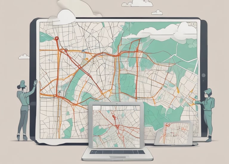
Web GIS Applications
Build interactive, web-based GIS applications that make spatial data accessible to your teams and customers.
Custom Web GIS portals using ESRI ArcGIS, Leaflet, Geoserver, Django
Cloud-hosted solutions for real-time mapping and analysis
APIs & integrations for connecting GIS with external systems


Spatial Analysis & Reporting
Extract valuable insights from spatial data with advanced GIS analytics and automated reporting.
Feasibility studies & GIS-powered decision-making
Automated mapping & reporting for businesses & municipalities
Predictive modeling & spatial statistics
Digitizing / Digital Twin Generation
Transform real-world infrastructure into high-accuracy digital twins for better asset management, planning, and simulations.
Georeferenced maps & 3D models from aerial and satellite imagery
Utility network digitization for water, electricity, telecom, and transport
Automated data processing for large-scale projects


Custom Tools for ArcGIS & QGIS
We develop custom scripts, plugins, and tools to simplify GIS workflows and enhance productivity.
Python-based automation tools for repetitive GIS tasks
Custom QGIS & ArcGIS add-ons for data analysis and mapping
Geoprocessing models to streamline spatial operations


We offer high-accuracy GIS survey solutions using GPS integrated with mobile apps.
Field data collection & mobile GIS solutions
Remote sensing analysis, Data Extraction
Customized GIS survey workflows
GIS-Based Survey Solutions
Enterprise GIS Database Setup


Ensure secure, high-performance GIS databases for data storage, backups, and multi-user access.
PostGIS, ESRI Geodatabases & SQL-based GIS solutions
Automated attribution & role-based permissions
Scalable cloud-hosted GIS databases
Utility Planning & Inventory Management


Improve infrastructure planning and GIS-based asset tracking for utility networks.
Utility network mapping (telecom, water, electricity, gas)
GIS-based city planning & urban infrastructure design
Asset management solutions with real-time location data
Contact Us Today
Get in touch for GIS solutions, data analytics, and customized tools. We're here to assist with your geography data needs.
Connect
+92 314 4756740
whatsapp
Inquiry
shawaz@geodars.com