Design and Drafting Service
Shawaz Ahmad, Muhammad Hamza
5/22/20253 min read
Comprehensive design and planning services for fiber to the home network deployments.
Feasibility Studies
Assess project viability with detailed BOM estimations and network architecture planning.
High-Level Design
Creating strategic HLD drawings validated through thorough field surveys for accuracy.
Low-Level Design
Detailed low-level design services ensuring effective implementation of FTTH network solutions.
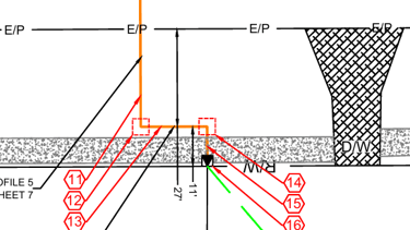
Permit and Construction Drawings
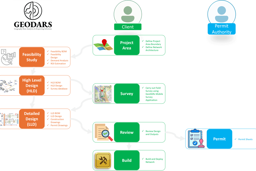
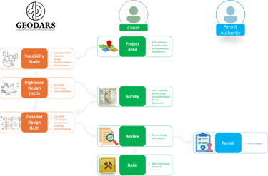
Ensuring compliance streamlined process, highlighting the interaction between clients, survey teams, permit authorities, and our design experts. From defining the project area to final network deployment, GeoDARs ensures every stage is executed with precision and efficiency.
At GEODARS, we specialize in delivering end-to-end design and planning services for Fiber to the Home (FTTH) network deployments. Our comprehensive suite of services includes
Welcome to GEODARS – Your FTTH Network Design Partner
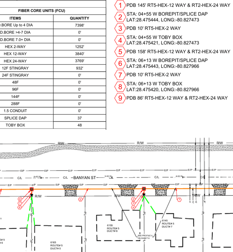
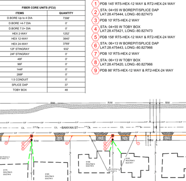
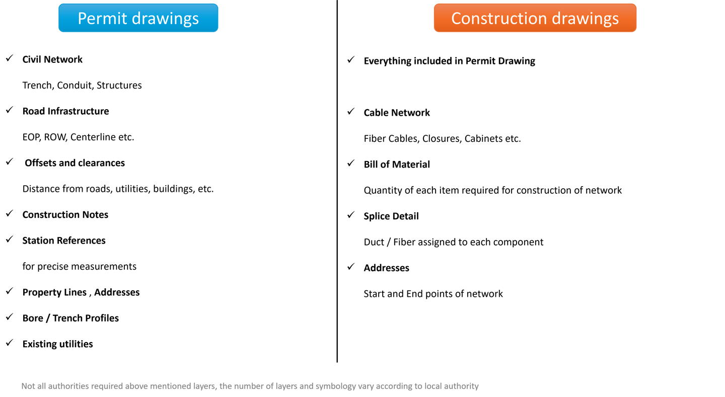
Construction drawings
Drawings submitted to municipal or city authorities for approval before construction.
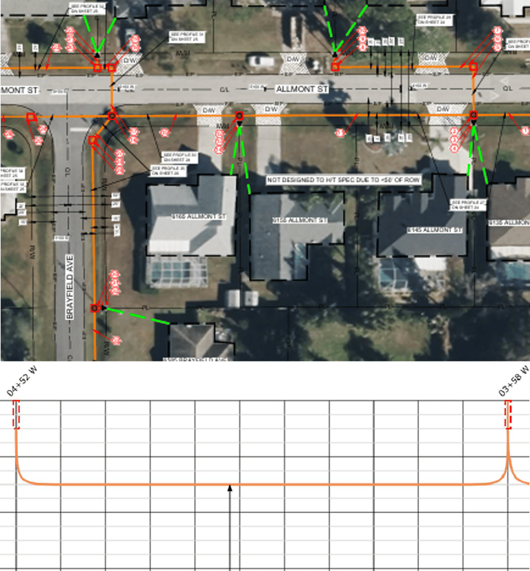
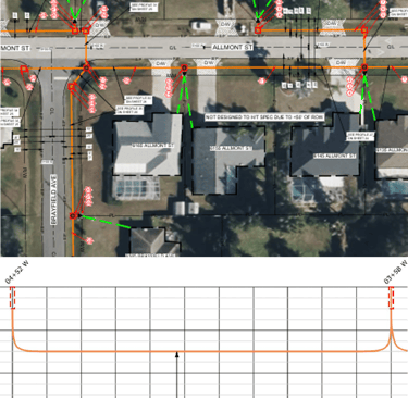
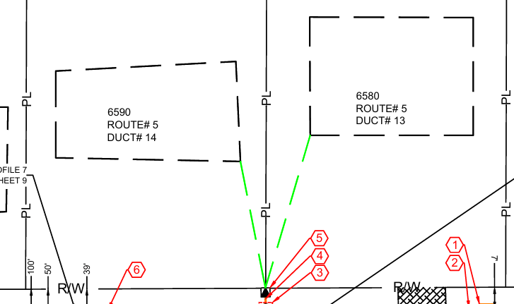
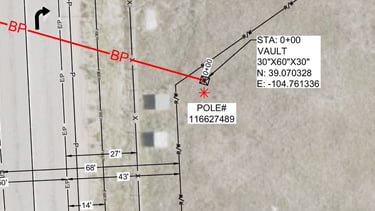
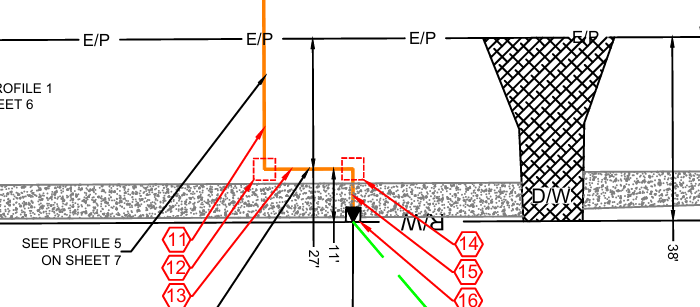
Include layers showing right-of-way, roads, utilities, trench paths.
Must follow local construction rules, symbology and formatting rules.
Permit drawings
Detailed plans used by field teams to execute the build
Include trench paths, cable types, structure locations, etc.
Follow engineering standards and are approved for actual deployment.
Delivered in PDF or GIS-based formats.
May also include Splicing details for networking
Reasons to make these Drawings
Legal approval (permits) before breaking ground
Accurate execution of network builds
Reduces rework and avoids utility conflicts
Keeps stakeholders aligned

Helps estimate project cost and resources accurately
Supports material/inventory planning and procurement
Improves project scheduling and budgeting transparency
Helps main Network inventory for future use, management and analysis
How are these produced
High-Level Design (HLD): Begins with planning the overall network structure including feeder routes, main fiber paths, and coverage areas. This provides the strategic foundation for the project.
Field Survey: On-ground validation to capture real-world site conditions such as obstacles, utility markings, road types, and trenching feasibility.
Low-Level Design (LLD): Detailed design stage where exact trench paths, duct counts, handhole placements, and cable routes are finalized. This aligns the design with both survey data and engineering standards.
Drawing Production: Drawings are created using platforms like CAD or GIS-based tools, structured with multiple layers (trench, ducts, fiber, structures) and proper legends/symbology.
Delivery & Export: Final outputs are reviewed, QA-checked, and exported in formats like PDF, or GIS shapefiles, ready for permit submissions, construction teams and ingesting the data in Networking Management Systems.
Why GEODARS – 100% GIS-Based Workflows
100% GIS: No AutoCAD Needed, All permitting and construction drawings are generated directly within GIS Environment using smart Geospatial models no CAD dependency / licenses!
Automation: Bill of Materials, duct numbers, route IDs, and structure codes are created using GIS logic and rules — no spreadsheets or manual labeling.
Georeferenced & Aligned with Survey Data: Survey data is directly ingested in GIS, Drawings are map-accurate and ready for submission matching local coordinate systems and survey points.
Fast, Scalable, and Customizable: Design for entire neighborhoods or cities with consistent logic and reduced design time — ideal for large-scale FTTH or OSP builds.
End-to-End Workflow in GIS: From survey import to trench layout, structure placement, and duct/cable assignment — everything is done within one platform. This allows full inventory management in GIS which allows integration with active components possible, and allow performing various types of analysis such as network tracing, dashboarding.